mapbox实现在地图上绘制指定半径圆
 六月初
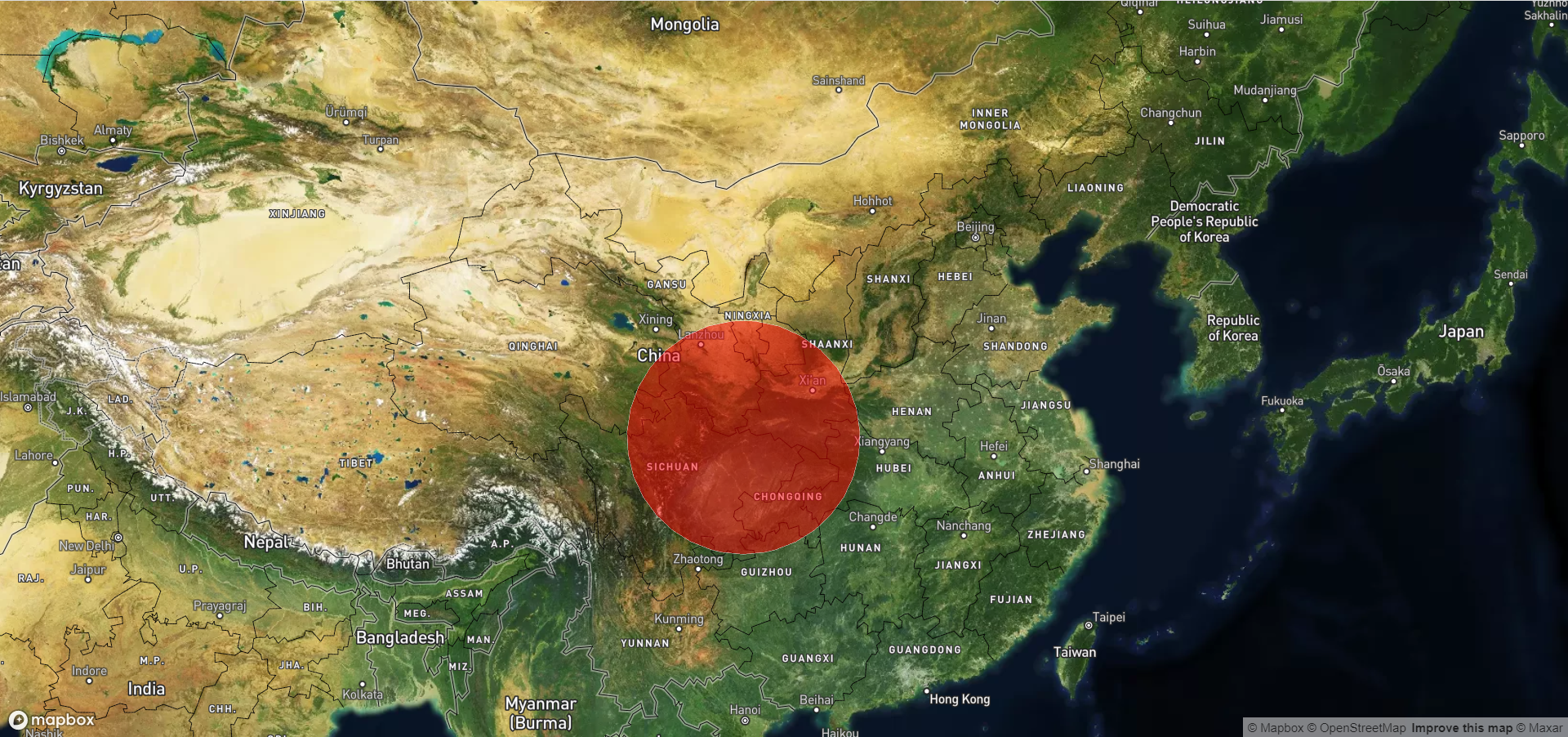
六月初mapbox实现在地图上绘制一个指定半径的圆,通过指定半径的圆的覆盖,可以看出在指定半径内覆盖了哪些区域,也可以根据该指定覆盖的半径区域看出你所需要的信息。
效果如图:
详细代码:
<!DOCTYPE html>
<html>
<head>
    <meta charset='utf-8' />
    <title>显示卫星地图</title>
    <meta name='viewport' content='initial-scale=1,maximum-scale=1,user-scalable=no' />
   <script src="https://api.tiles.mapbox.com/mapbox-gl-js/v2.9.2/mapbox-gl.js"></script>
   <link
     href="https://api.tiles.mapbox.com/mapbox-gl-js/v2.9.2/mapbox-gl.css"
     rel="stylesheet"
   />
    <script src="https://unpkg.com/@turf/turf@6/turf.min.js"></script>
	<style>
        body { margin:0; padding:0; }
        #map { position:absolute; top:0; bottom:0; width:100%; }
    </style>
</head>
<body>
<div id='map'></div>
<script>
	mapboxgl.accessToken = 'pk.eyJ1Ijoic2l4YmxvZyIsImEiOiJjbDYxdjNxbTcwMzZ3M2ZwNzkzOWJqNTI5In0.o6rf1thO5EbTqa5gXOJKYA';
	var map = new mapboxgl.Map({
		container: 'map',
		zoom: 4.5,
		center: [105.000, 38.000],
		style: 'mapbox://styles/mapbox/satellite-streets-v11'
	});

	const measureList = {
		'type': 'FeatureCollection',
		'features': []
	};
	const measureLinestring = {
		'type': 'Feature',
		'geometry': {
			'type': 'LineString',
			'coordinates': []
		}
	};
	map.on('load', () => {
		map.addSource('circleSource' , {
			type: 'geojson',
			data: {
				type: 'Polygon',
				coordinates: [
					[]
				]
			}
		})
		map.addLayer({
			id: 'circleID' ,
			type: 'fill',
			source: 'circleSource' ,
			paint: {
				'fill-color': '#f00', // 填充颜色
				'fill-opacity': 0.5, // 透明度
				'fill-outline-color': '#fff' // 边缘颜色
			}
		})
		var radius = 500000
		const geojson = turf.circle([105.778069 , 32.435930], radius/1000);
		map.getSource('circleSource').setData(geojson)
	})

</script>
</body>
</html>
代码解释:
用过mapbox提供的turf插件,可以在地图上绘制一个半径为500公里的半透明圆。
 六月初字帖坊小程序
你想要的字帖模板及工具,这里都有!
六月初字帖坊小程序
你想要的字帖模板及工具,这里都有!
816篇文章
2188人已阅读